
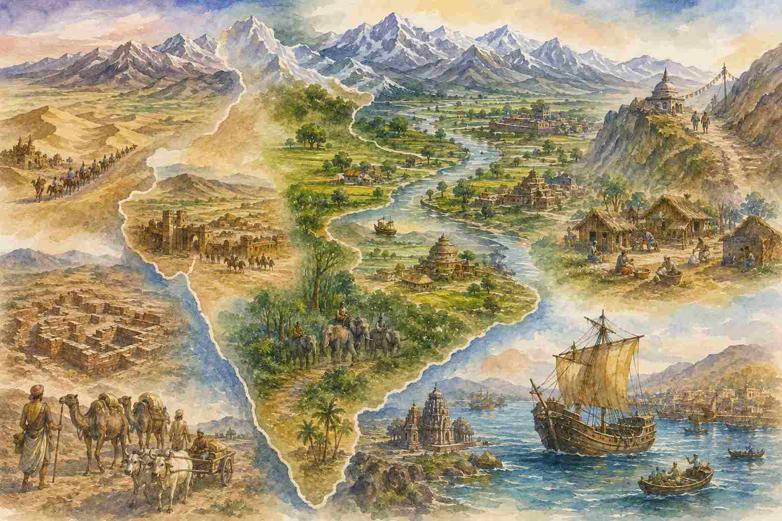
1. Geography before History
G. C. Pande begins Dimensions of Ancient Indian Social History with Geographical Identity. This is not accidental. For Pande, geography is not merely the physical setting in which history happens; it is one of the conditions through which a society understands itself. The historian must therefore consider both the geographical conditions of a people and the way in which that people conceived those conditions. In his broader method, deśa-kāla—place and time—forms part of the basic matrix of social action.
This gives us a useful geographical question: How does physical space become historical and cultural space? Mountains, rivers, forests, deserts and seas are physical facts, but settlements, routes, janapadas, sacred places and political regions turn them into human geography.
2. The Physical Structure of India
Pande begins with the geological structure of the subcontinent. India developed as a distinct geographical entity through Tertiary geological processes involving newly formed seas and rising mountains. He identifies three major geomorphic divisions: the Peninsula, the Himalayas and the Indo-Gangetic Plain. The Peninsula is the oldest, heavily modified by successive geological cycles; the Himalayas are younger, with a “youthful and highly differentiated” relief; the Indo-Gangetic Plain is younger still, formed through the accumulation of river-borne alluvium.
The historical significance of this physical differentiation is considerable. The alluvial plain became the great agricultural and demographic core; the Peninsula developed a different plateau-and-river geography; the Himalayas formed a formidable northern boundary while also providing passes and river systems connecting India with Central Asia. Pande notes that Arrian and Alberuni had observations that, in his view, anticipated aspects of modern geographical understanding.
3. Geography Is Not Static
One of Pande’s most important observations is that the geographical environment of ancient India was not identical to the present one. The Indo-Gangetic Plain experienced climatic changes even within historical times. Drying soils and deforestation altered its habitability. The Indus Valley supported urban civilisation in the third millennium BCE, when Sindh and Baluchistan were evidently less arid than they later became. The forests of Sindh must have been substantial enough to provide fuel for the production of millions of bricks, while Baluchistan received sufficient rainfall for the construction of stone dams. By Alexander’s time, lower Sindh and Baluchistan were considerably more arid.
The same principle appears in the history of the Sarasvatī. Pande notes the tradition that before its final drying, between approximately the 11th and 13th centuries, the river flowed towards the Rann of Kutch, which itself remained a substantial gulf until around the 9th century CE. He connects the changing river system partly with the eastward diversion of the Yamuna and westward diversion of the Sutlej. For geography students, the implication is straightforward: historical geography cannot simply project today’s rivers, forests and deserts onto the past.
4. From Landscape to Settlement
The expansion of settled life into the Indo-Gangetic region was closely connected with the transformation of landscape. Pande’s reconstruction places the early Vedic geographical horizon from Kabulistan in the west to the Yamuna and Ganga in the east. The region between Sindh and the Sarasvatī was associated with Sapta-Sindhu. During the later Vedic period, the geographical horizon moved eastward towards Bihar, incorporating the upper and middle Gangetic region into the expanding cultural field.
This was not simply migration across an empty landscape. It involved the transformation of forests and marshes into agricultural settlements. The plough drawn by oxen and the use of fire for forest clearance were important; the possible role of iron axes and ploughshares in the later expansion remains, as Pande notes, a matter of debate. The story of Videgha Māthava crossing the Sadanīrā preserves a cultural memory of movement into the eastern region later known as Videha.
Southward expansion similarly followed geographical corridors. The Rāmāyaṇa preserves a route from Prayāga → Citrakūṭa → Pañcavaṭī near Nāśik → Kiṣkindhā near Hampi, while another route went from Vaṅga → Utkala → Kaliṅga and further south. Samudragupta’s southern campaign followed another route through southern Kosala and Mahākāntāra to the eastern coast. Archaeologically, the Malwa gap provided a corridor through which post-Harappan Chalcolithic influence reached the Deccan.
5. Forest, Desert and Mountain: The Geography of the Frontier
Ancient India contained far more extensive forests than the present landscape suggests. Forest belts occurred around the Madhyadeśa and further east, while Kaliṅgāraṇya, Mahākāntāra, Vindhyāṭavī and Daṇḍakāraṇya formed a major forest zone between Āryāvarta and Dakṣiṇāpatha. Hsuan Chwang also mentions forests between the Indus and Saurāṣṭra, while Himalayan forests extended deep into the tarai.
This helps explain Pande’s use of the distinction between nuclear and refuge regions. Spate divides historical India into the Indus Valley, Hindustan and the Peninsula south of the Narmada, and further identifies agricultural “nuclear” areas and marginal “refuge” areas. Nuclear regions included Gandhara, Sapta-Sindhu, Kurukṣetra, Pañcāla, Saurāṣṭra, Malwa, Audh, Magadha, Kaliṅga, Andhra, Cola, Pandya and Kerala. Refuge regions included Rajputana, Gondwana, Bastar and the Rajmahal Hills.
Pande connects this distinction with the older opposition between madhyadeśa and pratyanta, the central and marginal regions. The Himalayas, Vindhyas and desert west of the Aravallis often functioned as protective frontiers. The Maru separated the Uttarāpatha from western India; the Vindhyas separated Āryāvarta from Dakṣiṇāpatha; forests, mountains and deserts provided spaces in which tribal political formations could persist. Yet Pande qualifies Spate’s model: movement was not only invasion from outside towards the centre. Expansion also moved from agricultural and political cores towards peripheral regions. Geography creates resistance, but it also creates corridors for expansion.
6. Jambudvīpa and Bhāratavarṣa: Geography as Cultural Memory
The Indian geographical imagination went beyond physical description. Hindu ritual begins with a saṅkalpa in which one’s location in space and time is recalled. Traditional formulations refer to Jambudvīpa, Bhāratakhaṇḍa or Bhāratavarṣa and Kumārikākhaṇḍa. Pande notes that Jambudvīpa is particularly ancient and that Ashoka used it for the realm under his rule.
Buddhist cosmography placed Jambudvīpa south of Meru and within the larger Himalayan world; its geography included the great rivers Gaṅgā, Sindhu, Sītā and Vaksu emerging from the region around Lake Anavatapta. Jain cosmography gave Jambudvīpa an even wider conception, while the Purāṇas divided the earth into seven dvīpas, with Jambudvīpa at the centre and Bhārata among its varṣas. Pande is careful here. The regions beyond the Himalayas in Purāṇic geography cannot generally be identified with confidence, and he suggests that Brahmanical accounts often relied more upon inherited cosmological imagination than direct geographical observation.
Bhāratavarṣa, by contrast, was defined geographically as the land north of the ocean and south of the Himalayas. The Mahābhārata recognises multiple Himalayan ranges, while the Himalayas and sea together form the principal natural boundaries. The land was sometimes imagined as tortoise-shaped, bow-shaped or triangular.
The important point is that Bhāratavarṣa was not merely a cartographic category. It was a geocultural region. Natural boundaries were reinforced by sacred places, ritual practices and cultural institutions. The Himalayas and sea supplied physical boundaries, while the north-west and north-east remained more open cultural thresholds.
7. Janapada: When People Become Territory
The concept of janapada provides another bridge between physical and human geography. Pande notes that jana originally had associations with people or clan, but that such communities gradually became territorial settlements—janapadas. The territorial meaning eventually became more important than the original tribal identity.
Ancient geographical divisions were numerous. The Atharvaveda and Aitareya Brāhmaṇa already present India through a fivefold division of the four quarters and the middle. Similar divisions appear in the Vāyu Purāṇa, Rājaśekhara and the Raghuvaṃśa. Samudragupta’s political geography can be understood through Āryāvarta, Dakṣiṇāpatha and Pratyanta, while the Mārkaṇḍeya Purāṇa offers sevenfold and ninefold schemes.
Pande identifies five principal geographical divisions:Uttarāpatha — Madhyadeśa — Prācya — Dakṣiṇāpatha — Pratīcya/Aparānta.
The Uttarāpatha included Punjab, eastern Afghanistan and Kashmir; Sindh and Baluchistan were associated with western India. Hindustan roughly corresponded to the later conception of Āryāvarta, while Madhyadeśa, Prācya and Aparānta differentiated central, eastern and western northern India. South of the Vindhyas lay Dakṣiṇāpatha, sometimes divided into eastern Deccan, southern India and western Deccan. These divisions were not modern administrative boundaries. They represented historical regions formed through ecology, settlement, movement, economy and political experience.
8. The North-West: Frontier and Gateway
The north-west was simultaneously India’s frontier and one of its principal gateways. Beyond the Uttarāpatha lay the Sakas, Pahlavas, Yavanas, Bāhlikas, Kambojas, Tuṣāras and other peoples extending towards Bactria, the Oxus and the Pamirs. Pande draws upon Herodotus, Strabo, Ptolemy, Isidore of Charax, Pāṇini, Kātyāyana, Manu, the Rāmāyaṇa, Mahābhārata, inscriptions and Chinese accounts to reconstruct this complex frontier.
Bactria was an important commercial entrepôt; Pande cites Hsuan Chwang’s dimensions of approximately 160 miles east-west and 80 miles north-south. From Bactria, routes crossed the Hindu Kush through Bamian or Khawak towards Arachosia and the Kabul Valley. Kapisi, near the junction of the Ghorband and Panjshir rivers, stood at the meeting point of routes from Kandahar, Bactria and Nagarahara. From there the northern highway proceeded through Nagarahara → Puṣkalāvatī → Udabhāṇḍa → Taxila. Taxila and Puṣkalāvatī were therefore not important merely because they were cities; their importance derived from their location within a trans-regional network.
9. Routes: The Geography of Movement
The great Uttarāpatha connected the north-west with the Gangetic and eastern regions. Pande describes its principal chain as running from Vāhlika to Tamralipti, with major junctions at Kāpisi, Taxila, Mathura, Varanasi, Pataliputra and Campa.
Mathura was the key centre of Madhyadeśa. The northern highway met here the route towards the western sea through Ujjayini and Bhrgukaccha. Under the Sakas and Kuṣāṇas, Mathura became a major centre of commerce, administration, religion and art. From Mathura the route continued towards Kanyakubja, Prayāga and Varanasi; eastward it reached Pataliputra, Campa and Tamralipti. Pande notes that boats travelled from Campa to Tamralipti and that the journey from Pataliputra to Tamralipti was said to take about a week by boat.
The southern network centred on Ujjayini, where routes from Mathura and Kauśāmbī, the western ports, and Mahishmati and Pratiṣṭhāna converged. From Malwa, routes turned west to the sea or south into Maharashtra. Coastal routes connected Tamralipti, Pāṭala and Bhrgukaccha with the southern regions and Sri Lanka. Ancient texts even classified different types of roads. The Mahābhāṣya, drawing upon Pāṇini and Kātyāyana, recognises Vāripatha (waterway), Jāṅgalapatha (desert route), Sthalapatha (land route), Kāntārapatha (forest track), Ajapatha (steep mountain track) and Śaṅkupatha (a precipitous “spike path”). This vocabulary reveals a sophisticated awareness of terrain-specific mobility.
10. Geography and the State
The Arthaśāstra makes the political importance of routes explicit. Roads were required for the movement of armies, merchants, officials, spies and supplies; their protection and regulation were therefore matters of statecraft. Geography became infrastructure.
The same relationship appears in Megasthenes and Ashoka. Roads accommodated different forms of transport, while Ashoka’s planting of trees and provision of water for travellers and animals transformed the road from a mere track into an organised public route. Inns and charitable rest houses further supported movement. The geography of the state was therefore not simply the territory marked on a map. It was the capacity to connect territory.
11. From Geographical Space to Civilizational Space
Pande’s geographical argument can finally be condensed into a simple progression: landscape → settlement → route → region → political space → cultural space.
A river valley becomes an agricultural core. Agricultural concentration produces settlements and towns. Routes connect those settlements. Connected settlements develop regional identities. Political powers organise them into janapadas and larger realms. Pilgrimage, trade, language, ritual and cultural exchange then connect regions beyond the boundaries of individual states.
This is why Pande’s distinction between geopolitical and geocultural space is so useful. The political boundaries of India changed repeatedly, but the cultural imagination could extend across those changing boundaries. The conception of cakravarti-kṣetra could accommodate regional janapadas, while sacred geography connected distant parts of the subcontinent.
The geography of India was consequently neither completely uniform nor permanently fragmented. It was a network of cores, corridors, frontiers and cultural regions.
Geographical Dṛṣṭi for students
The value of Pande’s chapter for geography students lies precisely here. Ancient Indian geography should not be studied merely as a list of places. It should be read through relationships:
Himalaya → frontier and water source
Rivers → agriculture and settlement
Forests → resource, barrier and refuge
Deserts → barrier and alternative corridor
River valleys → demographic and political cores
Malwa → north–south corridor
Taxila → Central Asian gateway
Mathura → northern-western junction
Ujjayini → central Indian crossroads
Tamralipti/Bhrgukaccha → maritime gateways
Janapada → people becoming territory
Bhāratavarṣa → territory becoming cultural space
The deeper lesson is that geography does not merely contain civilisation; civilisation continually interprets, transforms and connects geography. Pande’s Geographical Identity therefore provides a useful foundation for studying India as a historical landscape—one in which mountains, rivers, forests, roads, cities, regions and sacred places together produced a distinctive civilizational geography.
Principal sources used by Pande
The chapter brings together Ṛgveda, Atharvaveda, Aitareya Brāhmaṇa, Śatapatha Brāhmaṇa, Pāṇini, Kātyāyana, Patañjali, Mahābhārata, Rāmāyaṇa, Purāṇas, Buddhist and Jaina texts, Arthaśāstra, Raghuvaṃśa, Bṛhatsaṃhitā, Kāvyamīmāṃsā, Ashokan inscriptions, the Allahabad Pillar inscription, archaeological evidence, Herodotus, Strabo, Arrian, Ptolemy, Isidore of Charax, Fa-Hsien, Hsuan Chwang and Alberuni. Among the modern works Pande particularly uses are Cunningham, McCrindle, Wadia, V. S. Agrawal, S. M. Ali, Sylvain Lévi, Foucher, Tarn and S. M. Spate. His discussion of Purāṇic geography draws especially on S. M. Ali’s The Geography of the Purāṇas, while the nuclear/refuge-area model comes from Spate’s historical geography.
