
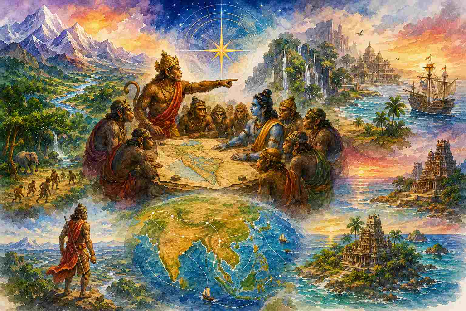
What if one of the most remarkable geographical descriptions in Indian literature appears not in a map, but in the instructions for finding a missing person?
Imagine a Geography classroom. The teacher places a map of Bharat before the students and asks them to identify rivers, mountains, regions and routes. Ganga. Yamuna. Narmada. Godavari. Vindhya. Malaya. The Himalayas. Kalinga. Videha. Kuru. China. Trade routes. Islands. Seas.
Nothing unusual. Then the teacher closes the atlas and opens the Valmiki Ramayana.
Suddenly, the class becomes uncomfortable. Is this now Geography—or Literature? Is this a text to be recited—or geographical knowledge? And this is precisely the problem. We have trained ourselves to recognise geographical knowledge only when it appears in the familiar form of a modern map, a coordinate, a survey or a textbook diagram. But what if a civilization remembered geography differently?
In the Kishkindha Kanda, after the monsoon and after the alliance between Rama and Sugriva, the search for Sita begins. Sugriva does something remarkable. He does not merely tell his forces: “Search everywhere.” He divides them by direction, appoints leaders, identifies routes, names rivers, mountains, forests, kingdoms, settlements, coasts and islands, warns them about difficult terrain and specifies a deadline.
This geographical narrative occupies Sargas 40 to 43 of the Kishkindha Kanda, with Sarga 46 returning to an equally interesting question: how did Sugriva know so much about the world?
The modern expression “Sugriva’s Atlas” is therefore useful—but we must understand it carefully. Sugriva does not unfold a modern paper atlas. There are no latitude-longitude grids. There is no scale bar in kilometres. What we have is something equally important: a textual geography, an ordered spatial imagination of the world in which direction, terrain, rivers, peoples, routes and political regions are remembered and communicated through narrative.
The story of Sita’s search thus becomes a fascinating geographical exercise.
First, a warning: this is not a modern atlas
Let us not make the opposite mistake. Every place described by Sugriva cannot simply be placed on Google Maps and given a modern pin. Some locations are identifiable with reasonable confidence; some correspond broadly to historical regions; some descriptions move into cosmological or mythic geography; some are textually difficult; and some sequences do not perfectly match the order expected on a modern map.
That complexity is not a weakness of the text. It is the first lesson for the Geography student.
A civilization does not necessarily organise geographical knowledge according to the categories used by modern geography.
The four great directions in Sugriva’s search are:
East — Sarga 40
South — Sarga 41
West — Sarga 42
North — Sarga 43
The geography then expands outward through a mixture of recognisable landscapes, political regions, ecological zones, distant lands, extraordinary beings and cosmological limits.
The Four-Directional Search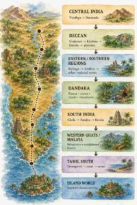
This should immediately interest a Geography student. The search is not organised by political boundaries. It is organised through directional movement and geographical features.
A party is not simply sent into “another country.” It is instructed to move through a world.
The Search Begins: Geography as Logistics
The entire episode begins with a very practical question. Rama does not ask Sugriva to explain the structure of the universe. He asks for two pieces of information: whether Sita is alive and where Ravana lives. In Sarga 40, Rama identifies these as the immediate objectives of the search.
This is where the geographical sophistication begins. Sugriva must transform an unknown world into a searchable one.
That requires:
- defining the area of search,
- dividing the territory into directions,
- appointing capable teams,
- identifying major routes and landmarks,
- distinguishing passable from difficult terrain,
- marking the outer limits of exploration,
- and fixing a time limit.
This is not merely geography as description. It is geography as operational knowledge.
Modern Geography students may recognise something surprisingly familiar here. Before a field survey, researchers define the study area, identify routes, prepare field teams, establish landmarks and decide how long the expedition will last. Sugriva’s search does exactly this—although in the literary world of the Ramayana.
The episode therefore asks us to rethink what geographical knowledge actually is. Is geography only the knowledge that appears on a map? Or can geography also be knowledge used to move through space?
The East: Rivers Become a Route
Sugriva first sends Vinata towards the east.
The instructions are remarkable because they do not merely list an “Eastern region.” Sugriva names a chain of rivers and territories, including the Bhagirathi, Sarayu, Kaushiki, Yamuna, Saraswati, Sindhu, Shona, Mahi and Kaalamahi, followed by regions such as Videha, Malava, Kashi, Kosala, Magadha, Pundra and Anga. The passage explicitly directs the searchers through rivers, mountains, forests and difficult terrain.
For the Geography student, this is a critical moment. A modern political map asks: Which state lies next to which state?
Sugriva’s geographical imagination asks something more layered: Which river systems, mountains, regions and ecological spaces form the world through which you must travel?
This is not a geography of neat rectangles. It is a geography of movement.
How Sugriva Organises Space
| Modern classroom geography often begins with | Sugriva’s search repeatedly uses |
|---|---|
| Political units | Directions |
| Fixed borders | Routes |
| Coordinates | Landmarks |
| Administrative regions | Ecological and cultural regions |
| Static maps | Movement through space |
| Resource distribution | Searchable landscapes |
This does not mean modern geography is wrong. The point is more interesting: the same Earth can be organised through different geographical questions.
A Geography Problem Inside the Geography
The eastern list also reveals why ancient texts cannot be read mechanically. The appearance of names such as Saraswati, Sindhu and Mahi in an eastern itinerary creates a problem when read against modern geographical expectations. The order does not correspond neatly to the direction in which a modern traveller would move through present-day Bharat.
What should a student do? The easy answer is to say, “The geography is wrong.” The equally easy answer is to say, “Every ancient identification must perfectly match the modern map.” Both are intellectually lazy.
A serious geographical reading must consider several possibilities: the semantic range of geographical names, differences in manuscript traditions, textual transmission and the possibility that the surviving sequence itself does not preserve a modern cartographic order. Traditional commentaries and later editions themselves discuss such difficulties.
This is precisely what makes Sugriva’s geography valuable pedagogically. Geography is not merely memorising locations. It is learning how to interpret geographical evidence.
Beyond the Familiar East
The eastern journey then moves beyond the immediately recognisable geography of Bharat. The search passes through islands, seas and distant regions. One of the most frequently discussed references is Yavadvipa, mentioned in the eastward search. But here we must be careful again.
A name in an ancient text should not automatically be converted into a modern nation-state. Historical geography works through probability, context, philology, archaeology and comparison—not patriotic enthusiasm with a laser pointer.
Still, the geographical significance is clear. The world imagined in the search is not confined to one village, one kingdom or one narrow river basin. The narrative extends through islands, oceans and distant lands. Geography here is already a connected world.
The eastward journey eventually reaches a cosmological horizon marked through Udaya, the mountain of sunrise, and other symbolic geographical features. This is important because ancient geographical texts often do not divide the world into “real geography” and “mythology” in the way a modern textbook attempts to do. Physical space, sacred geography and cosmological imagination coexist.
A student should not therefore ask only: “Is this a scientifically verifiable mountain?”
A better question may be: “What geographical boundary does this feature represent within the world imagined by the text?”
The South: The Most Familiar Geographical Corridor
If the eastward search demonstrates the expansiveness of the geographical imagination, the southern route offers one of the most recognisable sequences.
Sugriva sends Angada, Hanuman, Jambavan and other searchers south. Their route includes the Vindhya range, the Narmada, Godavari, Krishna, regions associated with Mekhala and Utkala, Dandaka forest, Andhra, Chola, Pandya and Kerala, followed by Malaya, Kaveri, Tamraparni, the southern ocean and the island associated with Ravana.
Read this slowly. This is not simply a list of place names. It is a journey through changing geographical zones.
The Southern Search as a Geographical Transect
The geographical lesson is obvious. The route is structured through relief, drainage, vegetation, forests, regions and coastlines. This is exactly what Geography should teach. A place is not merely a dot. A place exists within relationships.
The Godavari is not simply a river to memorise for an examination. It connects the Dandaka region, forested landscapes and movement across the subcontinent. The Malaya mountain is not merely an elevation. It appears in relation to forests, sandalwood and the Kaveri. The Tamraparni is not merely a blue line. It leads the traveller towards the sea. (
This is what might be called narrative geography.
Why Dandaka Matters to a Geographer
The Dandaka forest is especially revealing. Sugriva does not instruct the search party to “cross the forest.” He instructs them to examine its mountains, rivers and caves. That is a geographical method. A forest is not treated as an empty green patch. It is internally differentiated.
There are:
- routes,
- caves,
- rivers,
- mountains,
- ecological boundaries,
- and human or other forms of habitation.
How often does a modern map make this mistake? We colour a large area green and call it a forest. The people, routes, water systems, knowledge and internal landscapes disappear. Sugriva’s instructions suggest another possibility: to know a region, one must know its internal relationships. This is why ancient geography should not be judged only by asking whether it possessed modern instruments. It should also be judged by asking what it was capable of seeing.
The West: Where Geography Meets the Ocean
The western expedition moves through another geographical world. Sugriva describes rivers flowing westward, forests, wilderness, deserts, rocky regions and mountains before the search reaches the western sea. The itinerary then continues through coastal places, mountains and caves, and eventually reaches great symbolic boundaries involving mountains such as Hemagiri, Pariyatra, Vajra, Chakravan and Varaha.
For the student of physical geography, the opening itself is fascinating. Before naming distant places, Sugriva identifies drainage direction.
The west is not merely “the side opposite east.” It is associated with rivers flowing towards the west and with a distinctive ecological landscape. This is geographical thinking. Direction is not only abstract orientation. It is linked with the physical behaviour of landscapes.
The search party must move through:
rivers → forests → wilderness → dry landscapes → mountains → coast → sea
The landscape itself becomes the route. At the far western horizon, the narrative moves increasingly into sacred and cosmological space. Yet even there, the search continues to be described through movement, distance and geographical limits. Sugriva’s world does not have the same boundaries as a modern political atlas. And why should it?
The North: The Geography of Mountains, Peoples and Civilizational Worlds
The northern expedition is perhaps the most interesting for the student who wants to study the relationship between geography and civilization.
Sugriva sends Shatabali northward towards the snowy mountains. The route includes references to peoples and regions such as the Mlecchas, Pulindas, Shurasenas, Kurus, Kambojas, Yavanas, Shakas, Bahlika, China, Parama-China and Daradas, along with mountain systems and sacred regions.
What is happening here? Sugriva’s geography is not separating “physical geography” from “human geography.”
The northern world is understood through:
- mountains,
- valleys,
- rivers,
- peoples,
- political regions,
- routes,
- sacred places.
The physical and the human appear together. This is something Geography students should find deeply interesting. We have divided Geography into human geography and physical geography because modern academic disciplines require categories. But lived geography does not necessarily recognise those categories. A mountain affects movement. Movement affects trade. Trade affects settlements. Settlements produce political communities. Communities produce names. Names produce geographical memory.
Sugriva’s geography sees the world as a network before the modern syllabus divides it into chapters.
The Geography of the Known—and the Geography of the Unknown
One of the most fascinating elements of Sargas 40–43 is that Sugriva does not pretend to know everything.
The expeditions eventually approach regions where ordinary movement ends. The narrative identifies limits—places beyond which the search becomes impossible or where the text moves into extraordinary cosmological space. In the western instructions, Sugriva explicitly speaks of a point beyond which the region becomes unknown to the searchers.
This is a profound geographical idea. Every map has a horizon. Ancient cartographers sometimes wrote terra incognita—unknown land. Sugriva’s geography also possesses a distinction between the world that can be traversed and the world beyond the known horizon.
The difference is that the limit is expressed narratively rather than through an empty space on a map. A modern map usually tries to remove the second and third layers in order to create one homogeneous geographical space.
The Ramayana does not. And perhaps this is why it is so interesting.
Rama Finally Asks the Obvious Question
After the four expeditions have been dispatched, Rama asks what every modern reader may have been thinking: How does Sugriva know so much?
Sarga 46 contains this remarkable moment. Rama asks Sugriva how he knows the world so thoroughly. Sugriva’s answer is not that he possesses a secret royal atlas. He explains his own movement through the world. Because he had fled from Vali, he had travelled extensively, moving through regions and landscapes before eventually reaching Rishyamuka. In other words, his geographical knowledge emerges through movement and experience. This is one of the most beautiful geographical ideas in the entire episode. Sugriva did not merely study the Earth. He travelled through it.
And here we encounter a geographical method that the modern classroom has partly forgotten.
Sugriva’s Method of Knowing Space
Move → Observe → Remember → Relate → Narrate → Navigate
A satellite sees the Earth from above. Sugriva knows it from movement across it. Neither replaces the other. But why does our Geography curriculum increasingly produce students who can locate places on a screen without understanding what it means to travel through them?
Sugriva’s Atlas Is Not Really an Atlas
This is perhaps the most important argument. The phrase “Sugriva’s Atlas” is useful because it draws attention to the astonishing geographical range of Sargas 40–43. But in one sense, it can also mislead us. Sugriva does not produce a map. He produces a geographical network. The network contains:
- physical landscapes,
- rivers,
- forests,
- mountain systems,
- ecological zones,
- settlements,
- political regions,
- peoples,
- routes,
- islands,
- seas,
- sacred landscapes,
- and geographical limits.
This is much closer to the way human beings actually experience geography. We identify ourselves with places whose political boundaries may have changed repeatedly. This is why Sugriva’s geography is not merely an interesting ancient curiosity. It challenges the modern curriculum.
What Should a Geography Student Learn from Sugriva?
The lesson is not that the Ramayana should replace modern geography textbooks. That would be absurd. We need geomorphology, climatology, GIS, remote sensing, oceanography, surveying, cartography and spatial analysis. But the curriculum should ask a broader question: Where do our geographical categories come from?
If we begin only with the modern map, we may assume that geography means drawing territory. Sugriva’s search suggests something older and perhaps deeper. Geography is also about how beings move through the Earth and build knowledge of it. A river is not merely a drainage system. A mountain is not merely relief. A region is not merely an administrative unit. An island is not merely a territorial object. Each becomes meaningful through relationships.
This is why the Kishkindha Kanda should be read in Geography classrooms not as evidence for a simplistic claim that “everything was already known,” nor as mythology to be removed from serious intellectual discussion.
Both reactions miss the point.
The better question is this: What kind of geographical imagination does this text preserve?
The answer is fascinating. It preserves a geography in which space is travelled, remembered and narrated. It preserves a world in which rivers connect regions, mountains shape routes, forests create barriers and possibilities, and political regions exist within larger ecological landscapes. And perhaps that is the most interesting lesson for the modern student.
We have inherited maps that make the world look finished. Sugriva’s world is different. It is a world that must be searched. And perhaps that is what geography ultimately is—not the memorisation of a finished Earth, but the continuing effort to understand the world through which we move.
