When Geography Draws Boundaries but Life Crosses Them
What is a region?
A student of Geography is often introduced to the idea through maps. Political maps divide territory into states and countries; administrative maps divide them further into districts and municipalities. Physical maps show mountains, rivers and plains. Economic geography identifies agricultural, industrial and resource regions. The discipline becomes increasingly sophisticated, yet one basic problem often remains unexamined: are these regions actually the ways in which human beings experience space?
A boundary may separate two states, but a river may unite their economies. An administrative district may end, while a pilgrimage route continues. A language region may overlap with several political jurisdictions. A cultural world may survive despite the disappearance of the state that once governed it. Geography knows how to draw boundaries. But human geography must also explain why boundaries sometimes fail to contain the relationships that produce a place.
This is where the conventional curriculum requires expansion. Modern geography has developed sophisticated concepts of region, territory, scale and place. Yet much of geographical education still begins with the state as the most visible container of space. Bharat, however, offers another possibility. It can be understood not merely as a territory enclosed by a boundary but as a network of ecological, cultural, historical and civilizational relationships.
The difference is important.
The Region Is Not Simply There on the Map
The great geographical thinkers themselves questioned the simplistic idea that regions are merely natural units waiting to be discovered. Paul Vidal de la Blache understood regions through the relationship between human life and geographical possibilities. Carl Sauer moved attention towards the cultural landscape, showing that landscapes were shaped through the long interaction of people and environments. Richard Hartshorne placed regional differentiation at the centre of geographical inquiry. Yi-Fu Tuan later shifted the discussion towards place, reminding geography that space becomes meaningful through experience, memory and attachment.
Yet these ideas often become fragments within the curriculum. Students learn the names of schools of thought, reproduce definitions of region and move ahead.
The deeper question remains insufficiently explored: who decides where one region ends and another begins?
A mountain range may produce one kind of boundary. A language may produce another. A river basin may produce a third. A political state may impose a fourth. A pilgrimage network may create a fifth. These boundaries rarely coincide.
This means that a region is not always a fixed container. It may be ecological, political, cultural, economic or civilizational—and each of these can produce a different geography.
Territory and Place Are Not the Same
Modern states require territory. They need defined jurisdictions to administer laws, collect taxes, provide services and defend borders. Political boundaries are therefore real and necessary.
But a political boundary does not automatically create a sense of place.
A person may belong administratively to a district, culturally to a larger region, ecologically to a river basin, economically to a market network and emotionally to a landscape remembered through generations. Which one of these is his real geography?
Perhaps all of them.
This is where Indic categories become analytically interesting. Desha, kshetra, janapada, grama and rashtra should not be casually translated into modern categories such as “country,” “territory” or “village.” They refer to different scales and modes of spatial belonging.
Grama represents a lived settlement and social space. Janapada connects land with a people rooted within it. Kshetra can carry geographical, cultural and sacred meanings. Desha may indicate a region or country but also a distinctive cultural-geographical world. Rashtra cannot simply be collapsed into the modern nation-state.
The important point is not to produce an Indic glossary for geography. The point is that different spatial categories recognise different relationships between people, land and collective identity.
Modern geographical categories often begin by dividing territory. These categories often begin by asking how life is situated within it.
A Pilgrimage Route Has a Geography Too
Consider a political map of Bharat. It presents the country as a bounded territorial unit divided into states. This is necessary for administration. But does it explain Bharat?
Not fully.
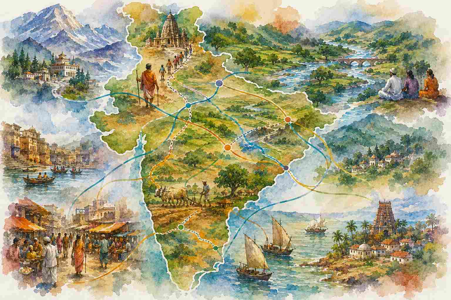
Consider instead the geography created by pilgrimage. Sacred sites connect mountains, rivers, coasts, forests and settlements across enormous distances. The geography of the Char Dham, Jyotirlingas, Shakti Peethas or the routes of major yatras cannot be understood through state boundaries alone. People travel across political jurisdictions while participating in a connected cultural landscape.
The same applies to rivers.
The Ganga does not understand state boundaries. The Narmada does not organise itself according to administrative districts. River systems create ecological relationships across political territories. Upstream and downstream populations may belong to different states, but their actions remain geographically connected.
Trade routes tell another story. Historical commercial networks connected regions long before contemporary administrative boundaries were drawn. Ideas, goods, technologies, communities and practices travelled along these routes. A region was often created not by enclosure but by movement.
This suggests an alternative geographical principle:
Some spaces are defined by boundaries. Others are defined by connections.
A serious geography must study both.
The Colonial Problem of Mapping Bharat
Modern cartography brought enormous precision. It enabled measurement, comparison and administration. But under colonialism, mapping also became a technology of control. Complex landscapes were classified into provinces, districts, estates, forests, tribal areas and revenue zones.
The map did not merely represent territory. It often reorganised how territory was governed.
This created a powerful administrative geography, but it could also separate landscapes from relationships that had developed historically. A forest could be classified as state property even when communities possessed older systems of access and use. A political boundary could divide cultural networks. A census or administrative map could standardise identities that remained locally fluid.
The issue is not that maps are false. The problem begins when the map becomes the only legitimate representation of space.
A map can tell us where a border exists. It cannot by itself tell us what relationships the border interrupted.
This is precisely where geography should become more critical. Every map selects. Every region includes some relationships and excludes others.
Bharat as a Network of Places
To understand Bharat only as territory is therefore to understand it partially.
A network approach reveals another geography. Rivers connect settlements. Trade connects markets. Marriage networks connect communities. Pilgrimage connects sacred landscapes. Language connects regions across political boundaries. Seasonal migration connects villages and cities. Food traditions reveal ecological adaptation. Monastic institutions and centres of learning historically connected intellectual worlds.
This does not mean that Bharat was always culturally uniform. A network is not the same as sameness. The strength of a network may lie precisely in the existence of different nodes connected without losing their distinctiveness.
Here lies an important contrast with the nation-state imagination. The modern political map often imagines unity through territorial enclosure: one boundary, one jurisdiction, one sovereign authority.
A civilizational geography may reveal another possibility: unity through relationships across diversity.
This may be one reason why Bharat has historically contained enormous linguistic, ecological, cultural and social diversity while retaining forms of connectedness that cannot be explained merely by central political authority.
The map of the state and the map of civilization are therefore not necessarily the same map.
What Geography Students Are Missing
The problem with the conventional curriculum is not that it teaches states, boundaries and regions. These are essential. The problem is the hierarchy of questions.
Students first learn to divide space into measurable units and only later encounter ideas of lived space, cultural landscape and sense of place. Geography becomes a science of classification before it becomes an inquiry into relationship.
What if the sequence were reversed?
Students could first ask: How do people experience this place? Then: What ecological systems sustain it? What historical networks connect it? What cultural memories shape it? Finally: What political and administrative boundaries govern it?
This would not weaken geographical science. It would make it more complete.
A decolonised geography curriculum would therefore bring the ideas of Vidal de la Blache, Sauer, Hartshorne and Tuan into conversation with Indic spatial categories such as desha, kshetra, janapada and grama. It would not claim that one tradition is universally superior. Rather, it would ask whether different traditions illuminate different dimensions of geographical life.
The modern map gives us the outline.
The lived geography gives us the connections.
Beyond Territory
A territory is something that can be enclosed, governed and defended. A place is something that is lived. A region may emerge from shared ecology, history, economy or culture. A civilization may exist through networks that no single boundary can fully contain.
These distinctions matter because geographical education shapes how we imagine the world.
If students are taught that every space is primarily a bounded unit, they may overlook the relationships that flow through boundaries. If they are taught that a region is simply a unit on a map, they may fail to understand why communities continue to feel connected despite political separation.
Perhaps the central question of geography should therefore be expanded.
Not simply: Where is this place?
But also: What connects this place to others, and what would be lost if those connections disappeared?
Because a place is never only the land within a boundary.
It is also the river that reaches it, the road that crosses it, the memory that remembers it, the people who move through it and the relationships that make that particular part of the Earth meaningful.
