
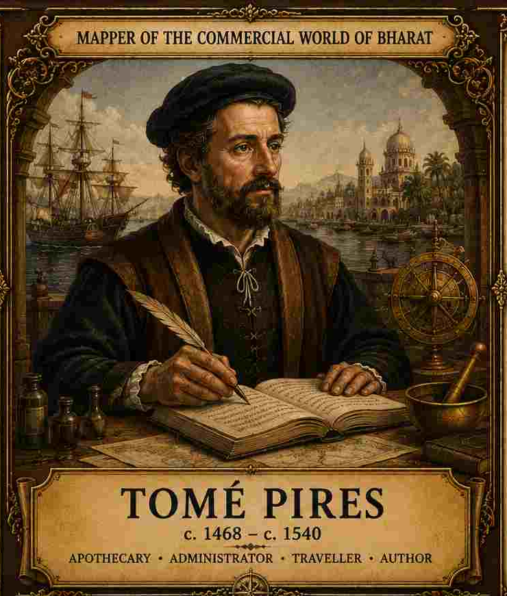
The Portuguese Apothecary Who Tried to Understand How the Commercial World of Bharat Actually Worked
There is a difference between travelling through a civilization and trying to understand how its commercial world actually functions, and Tomé Pires belongs firmly to the second category. Born around 1468 and trained as an apothecary, Pires came to the East in 1511 in Portuguese service. His initial responsibilities concerned drugs and medicinal commodities, but he soon became involved in the wider Portuguese administrative and commercial world of Cannanore and Malacca. Between 1512 and 1515, he compiled his great Suma Oriental, an enormous geographical, commercial and ethnographic account stretching from the Red Sea to China and Japan. The work records coasts, ports, kingdoms, commodities, merchants, ships and political powers across the Indian Ocean and Southeast Asia. Unlike a traveller writing only from memory after returning home, Pires was writing from inside the commercial machinery of the Portuguese Estado da Índia, and his work was intended to provide useful knowledge to the Portuguese Crown. That makes the Suma Oriental both extraordinarily valuable and inherently political. Pires was trying to understand Asia, but he was also helping Portugal understand where wealth was located, who controlled it, which ports mattered, what commodities moved through them and where Portuguese power might profitably intervene.
This is precisely what makes Pires so important for our series. If Abdur Razzaq looked at Vijayanagara through the perspective of a Persian ambassador, Niccolò de’ Conti through that of a Venetian merchant, Varthema as an adventurer moving through unfamiliar worlds, and Duarte Barbosa as a Portuguese official, Pires looked at Asia almost as a commercial cartographer of civilization. He wanted to know the ports, rulers, commodities, merchants, routes, political relationships and economic strengths of different regions. His account is therefore less concerned with spectacular monuments and more concerned with the circulation of value. Where did pepper come from? Who purchased it? Who transported it? Which port controlled it? Which ruler taxed it? Which merchants dominated the trade? What happened when a new political power entered an existing network? These questions make the Suma Oriental an unusually important source for understanding the economic geography of early sixteenth-century Bharat.
Major Work
Suma Oriental que trata do Mar Roxo até aos Chins
The title may broadly be translated as “An Account of the East, from the Red Sea to China.” Pires organized the work geographically, moving from the regions around Africa and the Red Sea through India and Southeast Asia towards China and Japan. The surviving scholarly edition prepared by Armando Cortesão for the Hakluyt Society remains one of the principal editions through which modern scholars have studied the work.
For the history of Bharat, the Suma Oriental is particularly important because its Indian sections discuss Cambay, Rajputana, the Deccan, Goa, Kanara, Narsinga or Vijayanagara, Malabar, Ceylon and Bengal. Taken together, these descriptions allow us to reconstruct something much larger than the history of individual kingdoms. They reveal a commercial geography in which political territories, ecological regions, ports, inland markets, merchant communities and commodities were connected to one another.
1. Pires Was Interested in Systems, Not Just Sights
One of the most revealing things about Tomé Pires is the nature of the information he chooses to record. He is certainly interested in rulers and kingdoms, but his curiosity repeatedly moves beyond visual description. When he encounters a city or region, he wants to know what it produces, what goods are sold there, where those goods come from, which merchants are present, what ships arrive, which routes connect the region to other markets and what commodities leave for distant destinations. In other words, Pires sees a civilization through circulation.
This is an extremely useful perspective for Civilizational Studies because civilizations do not survive merely through ideas, monuments and political institutions. They also require systems through which food, materials, wealth, labour, technology and information circulate. A political centre cannot sustain itself without productive networks. A market cannot function without transport and trust. A military system cannot operate without supply. A port cannot become important merely because ships happen to reach its shore; it becomes important because producers, merchants, political authorities and maritime routes converge around it. Pires therefore gives us something like an early economic map of Asia, although his map is not drawn only through lines and territories. It is created through relationships.
2. His Description of Narsinga Is Remarkably Precise
When Pires reaches the southern Indian kingdom that the Portuguese called Narsinga, he immediately establishes its political importance. He writes:
“The kingdom of Narsinga is large and very important.”
He identifies Vijayanagar as the principal city where the king resides and places the kingdom within a much wider political geography extending between the Deccan and the eastern and western coastal regions. Yet one of his most interesting observations concerns not merely the kingdom as it existed during his own time but its changing historical extent. He writes:
“In older times the kingdom of Narsinga was much greater than it is now.”
Pires explains that regions including the Deccan, Goa, Malabar and Orissa had emerged as separate political powers, although Narsinga remained one of the largest kingdoms in India. This is important because Pires is not simply recording the existence of Vijayanagara. He is recording territorial transformation. He understands that kingdoms expand and contract, that territories once incorporated within a political system can become independent powers and that political geography is historically variable rather than permanent.
This may appear obvious to us, but it is methodologically important. Too much historical writing freezes political maps and then reads the past through them as if present or familiar boundaries were natural and permanent. Pires’s account reminds us that political geography is itself historical evidence. Narsinga had a past larger than its present, and its present position could only be understood in relation to that earlier political geography. In this sense, his description moves beyond simple travel writing towards an early form of historical analysis.
3. Vijayanagara Was a Military Power
Pires describes the ruler of Narsinga as: “a warrior”
and states that he could go to war with: “more than forty thousand mounted men and a large number on foot.”
He also records: “He must have five hundred elephants, two hundred of which are for war.”
The exact figures should not be treated as a modern military census, and there is no reason to assume that every number transmitted by a sixteenth-century observer represents an exact administrative count. Nevertheless, the broader observation is unmistakable. Pires saw Vijayanagara as a major military state, one capable of mobilising large numbers of cavalry, infantry and elephants.
Perhaps even more important is his observation that the ruler was: “always at war, sometimes with Orissa, sometimes with the Deccan and sometimes inside his own country.”
This description places Vijayanagara within a highly competitive political environment in which military preparedness was not an occasional activity undertaken only during extraordinary emergencies. It was a continuing requirement of political life. The implications of this are much larger than the battlefield. What happens to an economy when military preparedness becomes permanent? Horses must be acquired, elephants maintained, soldiers fed, weapons produced, roads used, supplies transported and revenue collected. Military power therefore cannot be understood as an isolated institution standing outside economic life. The army is itself part of a much wider economic system.
4. The Horse Trade Connects Bharat to the World
Pires’s account becomes especially valuable when his description of Vijayanagara is read alongside his observations about the western Indian Ocean. He repeatedly records the importance of imported horses from Arabia and Persia to the kingdoms of western and southern India. This was not a minor luxury trade. Cavalry was central to military power, while the ecological conditions of much of peninsular India did not produce a comparable supply of high-quality warhorses. Political and military power in the Deccan and southern India therefore depended in significant measure upon commercial connections extending far beyond the subcontinent.
A horse could thus connect several worlds at once. It might be bred in Arabia or Persia, purchased by merchants operating within the Indian Ocean, transported across the sea to a western Indian port, sold through commercial networks and finally acquired by an inland political power for military use. What appears to be a military resource therefore reveals an entire transregional system connecting ecology, animal breeding, maritime commerce, merchant capital, ports and political power.
This is why Pires is so valuable. He allows us to see that political power in Bharat was connected to maritime commerce operating thousands of kilometres away. The horse was not simply an imported object. It was evidence of the way in which the political systems of inland Bharat were connected to the commercial systems of the Indian Ocean.
5. He Understood the Importance of Cambay
Pires devotes considerable attention to Cambay, one of the great commercial centres of western India. His description of the goods moving through the region is remarkably detailed. He records textiles, roots, catechu, rosewater, opium, seeds, grains, tapestries, incense and numerous other commodities. In one passage, he writes:
“The merchandise they bring is cloths of thirty kinds.”
He then records additional goods and explains commercial relationships connecting Cambay with other centres of the Indian Ocean. This is precisely what distinguishes the Suma Oriental from a conventional royal chronicle. A royal chronicle may tell us who conquered Cambay, which dynasty controlled it and which political conflict transformed its fortunes. Pires asks a different question: what was Cambay selling?
Sometimes that second question is more revealing than the first. Political conquest can explain who controlled a territory, but the movement of commodities reveals the productive and commercial relationships that gave the territory wider importance. Cambay was not simply an administrative possession of a ruler. It was a major commercial node whose significance emerged from what its producers created, what its merchants transported and which networks connected it to distant markets.
6. A Ship From Cambay Could Carry Enormous Wealth
Pires records that a ship arriving from Cambay could carry merchandise worth:
“seventy or eighty thousand cruzados, without any doubt.”
Again, this should not be treated as if it were a modern audited financial statement. Sixteenth-century valuations require caution, especially when they are transmitted through observers whose access to precise commercial accounts is uncertain. Yet the broader point is clear. Pires was attempting to communicate the enormous scale of commercial capital circulating through western India.
Cambay was not serving merely a local market. Its merchants and ships participated in long-distance commerce. Textiles and manufactured goods travelled outward, while spices and other commodities moved inward. The port connected inland production with the wider Indian Ocean, allowing goods produced in western India to circulate across maritime networks while foreign commodities entered the subcontinent through the same commercial system.
Cambay therefore becomes an excellent example of a commercial node within a civilizational network. Its importance cannot be understood simply by looking at its political status. We must examine the relationships that connected producers to merchants, merchants to ships, ships to ports and ports to distant markets.
7. The Merchant Was Often More Important Than the Port
One of the recurring themes of Pires’s work is the mobility of merchants. He records communities of Gujaratis, Arabs, Persians, Bengalis, Malays, Chinese and other groups operating across different ports. This matters because the Indian Ocean was not organised simply by territorial states. It was also organised by merchant networks that crossed political boundaries.
A merchant could live under one ruler, purchase goods in another kingdom, trade through a third port and sail towards a fourth political world. Political sovereignty was territorial, but commerce was capable of moving across territories. This distinction is crucial for understanding the economic geography of the Indian Ocean. We cannot reconstruct that geography merely by drawing political borders and assuming that commerce remained inside them. The more important task is to map the networks between the borders.
Merchants carried more than commodities. They carried information, commercial relationships, credit, languages and knowledge of distant markets. Their mobility connected political worlds that may otherwise appear separate in conventional historical narratives. Pires’s account therefore helps us see the merchant not as a secondary figure standing beneath kings and armies, but as an active agent in the construction of commercial geography.
8. Pires Understood the Power of Information
The Suma Oriental is, in many ways, a work about information. Pires collected and organised knowledge about ports, rulers, routes, commodities, currencies, merchants, ships, languages, religious communities, military strength and political rivalries. Taken together, this information amounted to something larger than a travel narrative. He was effectively creating a knowledge infrastructure for Portuguese expansion.
This is where the work becomes historically uncomfortable. The information Pires collected was not politically innocent. Knowing where spices were produced could be useful to commercial strategy. Knowing which ruler controlled a particular port could assist diplomacy. Knowing which merchants dominated a trade could help commercial competition. Knowing the routes followed by ships could serve naval power.
The relationship between knowledge and power is therefore embedded within the structure of the Suma Oriental. Pires was not simply curious about the world he encountered. His knowledge could be converted into political and commercial advantage. The work is consequently an early and important example of a broader historical transformation in which systematic geographical and commercial knowledge became increasingly useful to expanding imperial power.
9. He Was Sometimes Willing to Say: “I Do Not Believe This”
One of the most interesting features of Pires as an observer is that he occasionally distinguishes between information he accepts and stories he has merely heard. When discussing the claim that the rulers of Cambay were raised on poison, he remarks:
“But I do not believe this, although they say it is so.”
This small sentence deserves attention because it reveals source criticism within the source itself. Pires hears a claim and records it, but he does not automatically convert hearsay into established fact. He preserves the information while simultaneously informing the reader that he remains unconvinced.
This is precisely the habit that researchers in Civilizational Studies must cultivate. Not every tradition is automatically true, but neither is every foreign account automatically false. Not every traveller’s statement deserves equal weight. Some observations are based on direct experience, others on commercial information, others on political reporting and others on stories circulating among local communities. The task of the historian is to ask what kind of evidence lies behind the statement.
Pires, therefore, becomes interesting not only because of what he records but because he occasionally reveals his own process of evaluating information. The question remains the same for us today: what is the evidence, how was the information acquired and how certain can we reasonably be about it?
10. Pires and the Idea of Multiple Indias
Pires divides the Indian world into different commercial and geographical regions and uses terms such as First India, Middle India and High India, following the geographical conventions available to him. These categories are not ours today and should not be uncritically reproduced as modern geographical concepts. Nevertheless, they reveal something important about how a European observer gradually encountered the complexity of the subcontinent.
There was no single undifferentiated “India” in Pires’s commercial geography. There were different ecological zones, political systems, languages, commercial centres, agricultural products, ports and cultural formations. Yet these differences did not mean that the regions were disconnected. On the contrary, the very structure of Pires’s work reveals extensive networks linking them to one another.
This provides an important foundation for Civilizational Studies: unity does not require uniformity. A civilization can contain extraordinary internal diversity while still possessing networks of exchange, communication, pilgrimage, commerce, political interaction and cultural memory that connect different regions. The error lies in assuming that diversity must necessarily mean civilizational fragmentation or that unity requires the elimination of difference. Pires’s account, read carefully, shows us a vast and internally differentiated world whose regions remained deeply connected.
11. Language Itself Becomes Evidence
Pires records that at the court of Narsinga:
“the language is mixed, but his natural speech is Kanarese.”
This is a small observation with substantial implications. The court was not linguistically homogeneous. Political authority operated within a multilingual environment, and the ruler’s natural language could differ from the multiple languages used across his wider territories and institutions.
This is precisely the kind of evidence that a civilizational framework should take seriously. How does a large political system govern linguistic diversity? How does administration function across different linguistic regions? How do merchants communicate across language boundaries? Which languages operate within courts, markets, religious institutions and military systems? Pires does not theorise these questions, but he provides evidence from which they can be asked.
The history of Bharat repeatedly demonstrates that linguistic diversity did not automatically prevent political or commercial integration. Different regions could retain distinct languages while participating in shared networks of political authority, trade, sacred geography and cultural exchange. Pires’s observation therefore opens a much larger field of inquiry into how civilizational systems manage diversity without necessarily reducing it to uniformity.
12. Vijayanagara Was More Than Its Capital
Pires’s account helps us distinguish clearly between the kingdom of Narsinga and the city of Vijayanagara. The kingdom was vast, while the capital was one important centre within a much larger political and economic system. The territory contained different ecological regions and political relationships, bordered rival kingdoms, extended towards maritime zones and depended upon military commanders, mercenaries, merchants and productive communities.
This distinction is an important corrective to the modern tendency to reduce Vijayanagara entirely to Hampi. Hampi is the monumental surviving core and, for obvious reasons, has become the most visible representation of the civilization. Yet the Vijayanagara political economy extended far beyond the stone remains of the imperial capital. It included territories, agricultural landscapes, markets, routes, military networks and connections to coastal commercial worlds.
Pires therefore helps us reconstruct what might be called the network around the monument. The capital was spectacular, but it did not exist independently of the systems that supplied it and connected it to the wider world.
13. The State and the Merchant Were Interdependent
One of the most interesting implications of Pires’s account concerns the relationship between rulers and merchants. The ruler needed revenue, horses, luxury goods, military supplies, foreign commodities and access to maritime trade. The merchant, meanwhile, needed security, roads, ports, legal arrangements, political stability and access to markets. Neither could completely ignore the other.
This relationship between state power and commercial power is central to civilizational analysis. The question is not simply whether the state was powerful or whether commerce was prosperous. The deeper question is what institutional relationships allowed political authority and commercial networks to sustain one another.
Pires does not provide a complete theoretical account of these relationships, but he gives us fragments from which the larger structure becomes visible. Political power could tax trade and provide protection, while merchants could supply rulers with revenue, strategic commodities and connections to distant markets. These relationships were sometimes cooperative and sometimes coercive, but they were deeply interconnected. A commercial system without political protection could become vulnerable, while a military state without productive and commercial networks could struggle to sustain its power.
14. The Portuguese Were Learning Where the Wealth Was
Here we arrive at the uncomfortable heart of the Suma Oriental. Pires was not compiling this enormous body of information merely because he was fascinated by Asia. Portugal had a strategic interest in understanding the commercial geography of the Indian Ocean. Portuguese authorities needed to know where spices came from, which ports controlled them, which merchants dominated trade, which rulers might become allies, which powers were enemies, where ships could anchor, which commodities were available and which routes were profitable.
The Suma Oriental therefore belongs to a new historical phase in which geographical knowledge was increasingly converted into commercial and imperial strategy. This does not make Pires’s observations false. It changes how we should read them. He is not simply describing Bharat. He is also mapping Bharat for a power that intended to compete for control over important parts of its trade.
This distinction is essential. Knowledge has a history, and the institutional purpose behind the production of knowledge matters. Pires’s account remains valuable as evidence, but its strategic context cannot be ignored. The same work that helps us reconstruct the commercial world of Bharat was also potentially useful to a foreign power seeking a stronger position within that world.
15. Pires and the Indian Ocean Before European Monopoly
This is perhaps the most important reason to read Pires. His work provides a remarkably detailed picture of an Indian Ocean world in which Indian, Arab, Persian, African, Southeast Asian and Chinese merchants were already deeply connected. The Portuguese arrived in this world. They did not create the network; they encountered it and then attempted to alter the balance of power within it.
This distinction is historically fundamental. The arrival of Vasco da Gama in 1498 did not mark the beginning of Indian Ocean commerce. Commercial systems connecting the Red Sea, Persian Gulf, East Africa, Bharat, Southeast Asia and China had existed long before the Portuguese arrived. What Portuguese intervention introduced was a new European military and commercial power into an already functioning and highly complex network.
Pires’s work is one of the clearest documents of this transition because it records the network while Portuguese power was still attempting to understand and establish itself within it. The Suma Oriental therefore allows us to see both the pre-existing commercial order and the beginnings of the transformation that European military and commercial intervention would produce.
16. The Commercial Geography Was Polycentric
When Pires is read carefully, we do not find a single commercial capital controlling everything. Instead, we encounter a network of centres including Cambay, Goa, Cannanore, Calicut, Cochin, Vijayanagara, Ceylon, Bengal, Malacca, Aden and Hormuz. Each possessed different strengths and functions. Some were major producers, some redistribution centres, some controlled particular commodities, some possessed political power, some provided maritime access and others connected inland production with overseas routes.
This is remarkably close to what we might today describe as a polycentric economic system. The network was integrated not because one centre controlled every other centre, but because many different centres possessed different forms of importance and remained connected through commercial relationships.
Perhaps this is an important idea worth recovering for Civilizational Studies: civilizational integration does not necessarily require a single economic centre. A network can be integrated precisely because it contains many centres. The diversity of nodes may increase resilience by allowing different regions to specialise, exchange and continue functioning even when political conditions change in particular places. Pires’s commercial geography therefore challenges the assumption that integration must always take the form of centralisation.
17. Why Pires Matters Beyond Economic History
It would be easy to place Pires within the narrow category of “economic history” and move on. That would be a mistake because commerce touches almost everything. The availability of horses affects warfare, warfare affects political authority, political authority affects taxation, taxation affects merchants, merchants affect ports, ports affect cities and cities influence migration. Migration can reshape linguistic environments, while language affects administration. Agriculture supplies commodities, ecology determines what can be produced and maritime routes connect these systems to distant societies.
This is why Pires is so useful for our conception of Civilizational Analytics. He gives us evidence of relationships rather than merely lists of things. A commodity connects ecology to production, production to labour, labour to markets, markets to merchants and merchants to distant political worlds. A horse connects Arabian breeding systems to Indian military institutions. A port connects inland production to maritime networks. A language connects political authority to social communication.
Once we begin following these relationships, the distinction between “economic history” and “civilizational history” becomes less rigid. Commerce is one of the mechanisms through which different institutions encounter and influence one another. Pires therefore helps us study civilization as a system of connected processes.
18. Read Pires Against His Own Purpose
The Suma Oriental was an extraordinary intellectual achievement, but it must always be read with one fundamental question in mind: why was this information being collected? The answer is partly commercial and partly imperial. Pires was working for Portugal. His knowledge was useful to Portuguese administrators and merchants, while his descriptions could identify opportunities, risks, rival powers and potential advantages.
His work therefore represents an important historical shift in which the systematic observation of another civilization was becoming an instrument of political and commercial power. This should sharpen our own civilizational methodology. Knowledge is never entirely detached from institutions. Who produces knowledge? Who funds it? Who preserves it? Who uses it? Who benefits from it? These questions are not external to the history of knowledge. They are part of that history.
The lesson is not that we should reject Pires because he worked within a Portuguese imperial system. That would be intellectually self-defeating. His work remains an extraordinarily valuable source. The lesson is that source criticism must include the purpose of knowledge production. We should ask not only, “What did Pires know?” but also, “Why was this knowledge useful, and to whom?”
Why Tomé Pires Matters for Civilizational Studies
Tomé Pires gives us a Bharat that is difficult to see through a purely political narrative. Through him, we see Cambay’s textiles, ships carrying cargoes of enormous value, Arabian horses entering the Deccan, Vijayanagara’s military power, multilingual courts, merchant communities crossing political boundaries, ports connected across the Indian Ocean and commodities moving through different ecological zones.
Perhaps most importantly, we also see the emergence of a new kind of European knowledge. This knowledge was not merely curious about another civilization. It was increasingly organised in ways useful to commercial competition and imperial strategy. That makes Pires a fascinating figure in the history of civilizational knowledge. He was studying Asia, but Asia was also becoming an object of European strategic calculation.
There is an important methodological lesson here. To study a civilization is not only to study what the civilization contains. It is also to study the systems through which that civilization has been observed, classified, described and represented. Pires mapped ports, merchants, commodities and kingdoms, but perhaps, without intending to, he also mapped the moment when European knowledge about Bharat began to move from curiosity towards control.
For that reason, the Suma Oriental should not merely be read as an old Portuguese travel account. It should be read as a document of a changing world: a record of the Indian Ocean as it existed before European power had fully remade its political economy and, at the same time, one of the earliest systematic attempts by that emerging European power to understand the commercial civilization and networks into which it was preparing to intervene.
Primary Reference
Tomé Pires, The Suma Oriental of Tomé Pires: An Account of the East, from the Red Sea to Japan, Written in Malacca and India in 1512–1515, translated and edited by Armando Cortesão, Hakluyt Society, 1944.
The work should be read alongside other contemporary accounts in the series because Pires’s perspective is distinctive. Where other travellers often describe the visible city, court, monuments or customs of Bharat, Pires repeatedly directs our attention towards circulation: the movement of horses, textiles, spices, merchants, ships, information and political power. This makes the Suma Oriental particularly valuable for reconstructing not merely what the civilizations of Bharat looked like, but how their wider commercial worlds were connected.
